Additional information about the company
Ferry transportation. Loading and unloading, escort, port and dock service of ships. Port and harbor management companies
Detailed information about the enterprise
Ferry transportation. Loading and unloading, escort, port and dock service of ships. Ports available throughout the year, with customs fees, equipment for dry cargo ships, terminals for servicing container cargo, bulk cargo, warehouses and storage equipment, pilotage services, cranes, with a depth of more than 5 to 8 meters. Managing companies of ports and harbors. Services of ferry transportation of cargo laden transport, loading and unloading of ships, cargo containers in docks and ports, maintenance of ship machinery
Company headings
Transport and transportation
Company on the map, directions
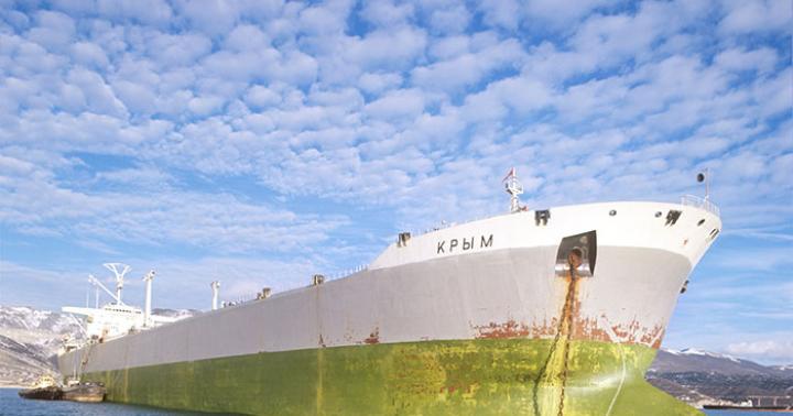
Kherson sea trade port, SE - a brief profile of the company
The company's activities are "Transport and transportation / Water transport, Transport and transportation / Transportation sea transport". Kherson marine company trade port, GP is located at 4 Ushakov Ave. Kherson 73000 in the Ukraine, Kherson region. You can contact the company representatives by the following numbers - +380 552 325252 +380 552 481464 +380 552 325274 +380 552 325348 Fax: +380 552 325252.
AIS (eng. AIS Automatic Identification System) - a system that allows you to identify and track vessel movement online with an accuracy of 10 meters. Apart from deployment of AIS ships provides information about their type, dimensions, destination, speed, expected time of arrival, makes it possible to get acquainted with the history of routes and the intended course. The specified information is presented in the card, to open which you need to click on the object of interest. Online access to AIS ships provided directly by ships using a radio frequency transmitter. Individual vessels or ports may not be viewable due to range limitations, interference, or weather conditions affecting radio communications. If a " marine traffic” does not display the item you want, please try again later.
Real-time vessel movement map covers the whole world and provides the user with the opportunity to see their placement in various ports and regions of the world. To find ships in other regions and ports, you need to zoom out on the map and select the desired sector.
The Answer-Logistic portal focuses on the current movement and positions of vessels according to AIS in the eastern part of the Gulf of Finland and the port of St. Petersburg. Note that deployment of ships displayed with a slight delay. You can find out the time elapsed since the last update of the coordinates by hovering over the object.
| Designations: | |
Marine Traffic is a resource with which you can track the position of ships on the AIS (Automatic Identification System) map. This is done very simply: in the search box you need to enter the name of the vessel, and the service will show where it is located in this moment. In addition to the name and type of the ship, you can find out its course, the country to which it belongs, the speed of movement and other useful data.
The service is convenient to use - courts different types are highlighted in different colors, the direction of their movement is shown, those who are at anchor are separately indicated.
Video: MarineTraffic - the world's most popular online ship tracking service
[yt=0oOOiXfE4mY] [yt=0oOOiXfE4mY]
When you hover over the icon, information about the ship appears in a pop-up window: name, home country, destination. If you click on it, the system will show more detailed information, up to the photo.
How does Marinetraffic work?
To create a map of vessels, AIS technology is used - automatic identification system. Each ship has a transmitter that constantly transmits information over the air using radio waves. It does not use mobile and satellite communications, so this technology is cheaper than analogues. Any receiver operating on VHF or VHF frequencies can pick up the signal.
Broadcast coverage depends on several factors. The most significant are the transmitter power and the height of the receiving antenna. But even the weakest repeater can broadcast within 75 km. This is enough for ships to recognize each other's presence from a safe distance.